Tuesday, December 27, 2016

An Industrious December

Moose in study area
After a month hiatus from serious work of any kind, December has been the exact opposite. I returned to my post as a Physical Therapist at North Valley Hospital and resumed my role as a field technician for Apryle’s PhD project. This in combination with the depressingly cold, icy, and short winter days in Tonasket has made it quite tough to keep up the mileage. 


Setting up a site
However, I have tried my best to keep up my training in preparation for an ambitious 2017 racing schedule that includes the competitive Chuckanut 50K and Lake Sonoma 50 Miler.


Deer in study area

The Project

Similar to the final weeks of 2015, Apryle and I are back in the field again this year setting out our Giving Up Density (GUD) trays. The experiment is quite similar to last year but we made a few modifications to hopefully increase success.


Apryle & I in the Field


     1. We set the trays out a few weeks early to allow a burn in period for the deer to acclimate to the presence of the trays. This would allow them to feel more comfortable eating out of them.
     2. We eliminated the use of the alfalfa cubes after noting that the captive deer at Washington State University had a difficult time eating them.
     3. We were sure to zip tie the grates to the top of the trays to ensure the deer would not simply take it out of the tray.


Rose Cuttings
In addition to the GUD portion of the experiment, Apryle decided to add another couple components. The first includes taking rose cuttings with the intention of counting the number of thorns on the stem. In theory, a stem that is more heavily browsed would concentrate more energy into arming itself with more defenses (thorns).


Seed Orchard in Study Area
The second component is collecting scat samples to analyze composition at a later date. Determining the composition of the scat will allow us to determine the diet of the deer at various locations (both wolf and non-wolf areas).


Training

Month
December
Dates
1 to 3
Miles
24.91
Time
3:56:50
Vertical (ft)
2,933
Long Run
10.5
December
4 to 10
67.2
8:10:39
3,103
10.1
December
11 to 17
61.21
9:08:41
8,954
15.11
December
18 to 24
50.54
6:37:06
3,753
10.13

Overlooking HW 20 Corridor
Airport Hill Road – After running the dirt road up to the local airport a few times this summer, I greatly increased the volume of trips this winter. The route offers beautiful panoramic views of the mountains and the city of Tonasket below. With a total of 500 vertical feet and 6 miles on stone road, it makes a perfect lunch break run.
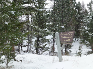


Okanogan National Forest
Whistler Canyon – This is a trail I wished I would have run more this summer when I was working in Oroville. In fact I enjoy this run so much that Apryle and I decided to create a 50 mile race here for 2017. This winter the canyon is particularly stunning with a dusting of white snow highlighting the tan cliffs.


Okanogan Skyline
Apryle and I covered the looped trail around Black Diamond Lake early in the month and since, I have done several out and backs up canyon. The first 2.5 miles of the trail gains well over 1,200ft. I have spotted several dozen Big Horn sheep that appear more prominent in the winter. Also after discovering strings of Mountain Lion tracks in the snow, I increased my level of vigilance.


Sled-Dogs
Tonasket Track – Due to the decreased daylight hours, there have been several occasions in which I have been relegated to the track. Typically, the snow has been packed enough to keep a solid pace, which is nice to knock out miles quicker.


Running Post GUD Setup

Random Forest Service Downhills – Apryle and I have been setting out our GUD trays across Okanogan and Ferry County and after finishing our work Apryle drops me off at the last site and I run back to the start of the road. Typically, this allows me to make a quick descent down a plowed logging road ranging from 5 to 10 miles. I throw on some yaktrax and bomb downhill as fast as possible trying my best to absorb the beautiful scenery.


Sunday, November 27, 2016

Ohio Bird Sanctuary & Mohican State Park

Blue Jay Perching
Ohio Bird Sanctuary is a non-profit organization that rehabilitates Ohio’s native birds. The 90 acre sanctuary is situated just southwest of Mansfield and includes hiking trails, birds of prey and a walk-through songbird aviary. It appeared that most of the birds of prey that were captive on site would be unfit to survive in the wild due to injuries sustained in automobile accidents. 

White-Breasted Nuthatch

Some of the raptors that were on site included: Rough-Legged Hawk, Red-Shouldered Hawk, Red-Tailed Hawk, Osprey, American Kestrel, Bald Eagle, Turkey Vulture, and Peregrine Falcon. The owls included: Eastern Screech Owl, Barn Owl, and Barred Owl. 


Dad and the Jay
The songbirds in the aviary consisted of: Blue Jays, Cedar Waxwing, Baltimore Oriole, Northern Cardinal, White-Breasted Nuthatch, and Mourning Doves. A few Crows, Chickens, a Red-Bellied Woodpecker and a Gull rounded out the vast diversity of species. 


Ohio Bird Sanctuary
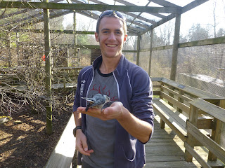
The walk-through aviary was my favorite part of the sanctuary, the enclosure contained several bird species as well as shrubs and trees within. There was a raised boardwalk that traversed the length and allowed ample bird observation. The Blue Jays were quite bold and would often perch on our hands, shoulders and even Dad’s head. 


Ohio Bird Sanctuary
The Nuthatch was a little shy but did eat a few seeds out of my hand. Food cups were available for 25 cents at the visitor center. The Jays were quite smart and would immediately go for the highest calorie treat out of the food cups. The hiking trails in the area were very well groomed and offered excellent birding opportunities. My parents and I looped the one-mile Wood Duck Trail along the creek. The facility was clean and well kept and easily one of the most fun and unique places to visit in Northern Ohio. 

Tom Wilkin & I at Mohican SP
In addition to the Ohio Bird Sanctuary, I also highly recommend exploring nearby Mohican State Park. Mohican State Park is a 1110 acre park that is located just south of Loudonville. During the summer months there are excellent opportunities to canoe the Mohican River. Additionally, there are roughly 45 miles of trail within the state forest and park that allow an excellent chance to explore the landscape. 

Mohican State Park
The gorge that carves its way through the park was the result of erosion from glacial melt waters as well as the current course of the Clear Fork of the Mohican River. The forest consists mainly of deciduous trees but there are also Hemlock stands and old-growth white pine forests. The latter of which has lead to the National Park Service declaring the area as a Registered National Landmark. 

Little Lyon Falls
Being an avid reader of author Allen Eckert, and his masterpiece Winning of America series I am quite familiar with the history of the Ohio frontier. This area is rich in Native American history as it was once the hunting grounds of the Delawares. Unfortunately after the War of 1812 many of the Native Americans that lived in the area were driven out and settlement of the region increased. Even if the preserved area is only about 23 square kilometers, at least a snippet of this unique landscape is available to explore. 


Wood Duck Trail (OBS)

Mohican State Park

Nuthatch at Ohio Bird Sanctuary
Upper Lyon Falls

Mom on Wood Duck Trail (OBS)

Blue Jay at Ohio Bird Sanctuary

Monday, November 21, 2016

Bill’s Badass 50K

Bill's Badass 50K
Background
I made the decision to travel back home to visit my family in the latter part of November this year. While sifting through races on ultrasignup I came across Bill’s Badass 50K. This race was not only taking place in the timeframe I was home, but it was also in one of my favorite places in the country – The Cuyahoga Valley. I spent four years at Baldwin-Wallace College where I trained at the Millstream Run and Rocky River Reservations. Therefore, I consider the Cleveland Metroparks my second home.


Everett Covered Bridge
The race featured 4,472 feet of vertical gain and six loops in the southwestern portion of Cuyahoga Valley National Park. Under direction of Bill Bailey and Bill Wagner the race has been going strong for eight years (I believe). Most importantly the race raises money for various charities, this year the proceeds benefited Girls with Sole. This is a great program that “uses free fitness and wellness programs to empower the minds, bodies and souls of girls who are at-risk or have experienced abuse of any kind”.


With Bill and Bill Post Race
Location History

Cuyahoga Valley National Park is a 32,950-acre swath surrounding the Cuyahoga River, which reclaims and preserves the urban encompassed landscape between Akron and Cleveland. The Recreation Area became Ohio’s first and only National Park in 2000. The Cuyahoga River is a V shaped river that empties into Lake Erie and is steeped in history. The Native Americans utilized the river as a trade route, and provided the name, which means crooked river. The Western Reserve settlers used the river to fill the Erie Canal in 1827, leading to the rapid industrialization of northeast Ohio. Subsequently the river became an oozing mix of sewage and industrial waste, which caught fire nine times. Fortunately a 1969 river fire was a catalyst for a nationwide Water Quality Improvement Act.

Blanding's Turtle at Pokagon
The 22-mile Burning River is a work in progress but the efforts to improve the ecological health of surrounding tributaries and wetlands in Cuyahoga Valley NP have led to re-colonization of many animals thought to have been extirpated from the area. The park is a mosaic of habitats consisting of deciduous mixed-mesophyic forests, wetlands, and cultivated agricultural lands.


A Muddy Exit

The Race

The course is a five-mile loop that starts and ends at the Everett Covered Bridge. This year the race took the counterclockwise route that featured a few hill climbs and some Furnace Run crossings. The trail meandered through thick deciduous forest; the ground was covered in leaves and the path slick and muddy. The weather was less than ideal, rainy and low 40s for most of the race. The rain ceased around the third lap, but a fleeting sleet storm struck around the fifth lap.


Bill's Badass 50K Course Map
The first portion of the course went under the covered bridge then crossed a road before ascending a gradual hill that led to a flat stretch along the park boarder. Then a few curves in the trail cut down to the second road crossing which marked the half waypoint. After crossing the road, a series of creek crossings, rolling hills and tight turns highlighted the next mile. Immediately following the final creek crossing began the climb up the steepest hill in the race. After cresting, there was a mile flat portion that was quite runnable with the exception of the slick mud. The final descent consisted of a few switchbacks back down to the covered bridge.

Bill's Badass Elevation Profile
Each lap my dad was there to encourage me on and hand me gels. After running the first lap in 39 minutes, I knew that a sub-four effort was out of reach given the trail conditions. The subsequent laps became slower and slower and my last lap took about 46 minutes. During the race I consumed about 24 ounces of water, 600 calories of Tailwind and 200 calories of gels. After the sixth lap we were directed up a set of winding staircases for one final ascent. Here we were tasked with grabbing a pack of crickets and descending back to the start/finish. I came through in 1st place with a course record time of 4:28:14.

Closing Remarks
Pokagon Trip with Goose & Hootie Next Day

The course was well marked, the landscape was beautiful and exactly how I remembered the old days running in the greater Cleveland area. The race directors did a phenomenal job, one of the most fun and memorable events of the year! Thank you to all of the volunteers for braving the weather. Thank you to my family for their support. Thank you to Ezekiel and Sara for letting me crash at their apartment in Medina. Thank you to my Tibialis Anterior for not flaring up too badly during the race. Thank you to my father for driving up with me, encouraging me on and supporting me through my first race in Ohio since 2012.

Statistics

Lap Splits

Lap #
Lap Time
Lap Pace
Cumulative Time
1
39:54
7:58
39:54
2
40:24
8:04
1:20:18
3
43:30
8:42
2:03:48
4
44:09
8:49
2:47:57
5
45:15
9:03
3:33:12
6
46:33
9:18
4:19:45
Final Mile
8:56
8:56
4:28:14

IMTUF 100 Miler to Bills Badass 50K Training Block

Month
Dates
Run Miles
Time
Elevation
Longest
Bike Miles
September
18 to 24
3.13
0:24:07
144
3.13
32.45
September
25 to 1
56.34
11:05:13
6,581
10.21

October
2 to 8
53.33
9:35:17
7,211
14.06

October
9 to 15
71.59
10:55:55
7,395
18.34

October
16 to 22
54.81
7:39:58
4,983
15.03

October
23 to 29
71.22
11:17:36
10,253
20.03

November
30 to 5
59.99
12:44:48
6,132
17.13

November
6 to 12
62.82
13:09:54
7,070
14.9

November
13 to 19
60.94
9:57:08
8,545
31
24.6
Totals
9 Weeks
494.17
86:49:56
58,314
31
57.05