|
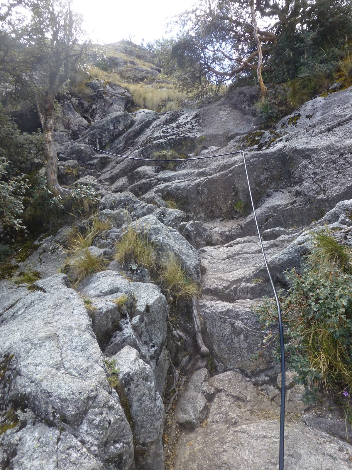
| Hiking near Rondoy Pass |
The decision to honeymoon
in Peru was due in large part to Machu Picchu; however, after reading into the
various mountain treks in the country, Apryle and I quickly became engrossed in
planning other adventures. After ample research by Apryle, we landed on the
Cordillera Huayhuash trek as our apex adventure.
 |
| Our Huayhuash Trek Provisions |
We poured over various trip
reports, purchased the Alpenvereinskarte map, and plotted out our own journey. Logistically,
the easiest part of the trek would have been the trek itself. This was due to
the amount of planning that was required in regards to obtaining enough food,
coordinating transportation, and carrying enough supplies to handle the harsh
weather of the Andes.
 |
| Huaraz |
After our time at Machu
Picchu and Ollyantaytambo, we flew from Cuzco back to Lima, then took a bus
from Lima to Huaraz. Huaraz served as our launch point for the trek, we
purchased food and supplies and organized ourselves before making our way to
the starting point in IIamac. Because our packs and gear were rather bulky it
did not leave much room for all the calories we would need to consume. In the
market many of the vendors were laughing at the quantity of spaghetti and oats
we were purchasing, but it was the best we could find in Huaraz.
 |
| Apryle on Huayhuash Trek |
Hauraz is a the capital of
Ancash and is home to over 100,000 people. The city sits at an elevation of
about 10,300 feet. Hostels are around 40-60 soles per night and many will store
packs for the day. There are plenty of grocery stores and market places
throughout the city that offer a relatively limited selection for long trek
foods. The town is easily navigated, but many of the downtown streets look
similar and it is very easy to loose a nondescript hostel, so take note of
memorable signs and landmarks. In terms of entertainment, Apryle and I were
fortunate enough to sit in on Inkafest, which is a mountain film festival and
also see an organized street breakdance battle in the downtown.
 |
| Hiking out of Llamac with Victor and Guide |
Once our packs were loaded
to the brim, we coordinated our busing to the start of the trek. The first bus
is easy to get tickets for at the local bus stop but it only goes as far as
Chiquian, 111 kilometers to the south. From Chiquian we caught a bus that stops
most mornings and also serves as transportation for many locals, which appears
to be subsidized by the tourists.
 |
| Pampa Llamac |
This bus took us on a precarious 27 kilometer
road to the town of Llamac, which is the traditional starting point of the
Huayhuash trek. As the bus nears the city, foreigners must sign into a registry
book and pay a small fee, then a few locals guided us out along the first few
kilometers of the trail.
 |
| Day One of the Huayhuash Trek |
Apryle and I set off on
the trail with a Peruvian friend we met in Chiquian named Victor with plans to
camp in Incahuain that evening. It was a warm day despite being upwards of
10,300 feet and in the middle of winter in the southern hemisphere. The first
few miles of our hike were slow going, there were dozens of switchbacks and our
packs were about 25 and 15 kilos respectively.
 |
| Grandfather Cacti |
We were treated to our first
views of the glaciated peaks after cresting Pampa Llamac (14,015ft). From this
point we descended along a forested trail that eventually spit us out into a
meandering valley floor. The meadows were inhabited by livestock and there were
make shift stone walls and huts dotting the landscape. However, my favorite
part of the valley was the prevalence of my favorite plant – Cephalocereus
senilis or Grandfather Cactus.
 |
| The View from Incahuain |
Overall our first day on
the trek went very well, we covered 8.5 miles in 4:12:16 with 4,268ft of
vertical gain and 1640ft of vertical loss. We kept a leisurely pace and were
able to appreciate our surroundings. Our first night on the trek was a
nightmare… The wind was whipping down through the canyon so aggressively that
the tent was barley able to stay up right, the temperatures dipped below
freezing, and on top of that, there was a midnight confrontation just outside
our tent walls.
 |
| Andean Geese |
When we awoke our friend Victor informed us that his boots were
stolen in the night. He said that his guide was able to gather all the other guides
together and locate the thief. Unfortunately for Victor, this incident ended
his trek for fear that the thief would attempt to take revenge on him and his
guide at a later stage in the circuit.
 |
| Day Two on Huayhuash Treks |
After learning of Victor’s
evening confrontation and his abandonment of the hike, Apryle and I debated
whether we should continue for fear of our own safety. Ultimately we decided to
continue to press onward. The second day started with some great birding, we
saw a Ruddy Duck, Andean Geese, Mountain Caracara, and Andean Ibis. The first 5
kilometers transitioned quickly from valley floor up a steep gulley toward
Sambuya Punta at 15,551 feet. After 1,729 feet of ascending we stopped to eat
some packaged papas fritas and drink some iodine treated water.
 |
| Ascending from Incahuain |
The next
stretch was about 4 kilometers of snaking along a scree strewn ridge line,
followed by a series of gradual switchbacks back into a valley. This was a
beautiful stretch of trail, but also a little scary with the wind gusts
threatening to send us off the ridgeline due to our large pack altered center
of gravity. We toped out at 15,584 feet when we passed over Rondoy Punta; the
highest we had ever been.
 |
| Day Two on Huayhuash Treks |
It was also during this
time that a local farmer lead us down the difficult to discern trail that
meandered through pastures and over rambling streams. We stopped to refill and
treat our water before following a dirt road for 3.5 kilometers to our next
campsite – Quartelhuain. When we arrived here we decided to camp near a little
stone hut with a thatched roof. It was still early in the day, so we decided to
cook down some of the weight in our pack. It seemed however, that we were
loosing our appetite for some reason…
 |
| Cordillera Huayhuash |
The camp was filling up
with guided tour after guided tour, and it seemed that this was the spot that
most started the trek. Personally, I could not imagine missing out on the
stretch from Llamac to Incahuain; but I understand logistically it is probably
easier. As darkness engulfed our tent, we tried to get some rest before our
next segment that would lead us to either Mitucocha camp or Carhuacocha camp
(depending on ambition).
 |
| Day Two on Huayhuash Treks |
Unfortunately the night
was anything but restful, nausea and diarrhea set in making sleeping
impossible. When we began to pack up the next morning we were so fatigued that
it took twice the time to even pack up the gear. After recharging from the strenuous packing, we decided to start
out down the trail and see if we could overcome the extreme fatigue that comes
with our suspected ailment – giardia. Unfortunately we only made it a quarter
mile before we realized that our trek was over.
 |
| Quartelhuain Campsite |
We descended back to the hut
and this time set up our tent inside. We rested the whole day and ran through
scenarios that could have caused us to ingest the parasite. Although the
streams were the obvious culprit due to the burro and cow feces, we treated all
of our water with iodine, so this was improbable. We eventually landed on the
fact that we probably contracted it from a restaurant where the vegetables were
washed with dirty water.
 |
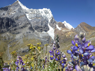
| Llaca Lake |
We decided to stay another
night to see if the symptoms would miraculously resolve, and when we awoke the
next morning we were even more fatigued. So we were in one of the most
beautiful places on earth, unable to move more than 200 meters at a time, it
was like a cruel prank. We began to worry about how we would get back to Huaraz
and how we were going to recover in such an inhospitable place.
 |
| Hiking Churup |
We got
extremely lucky, a German family that spoke both English and Spanish offered to
give us a ride to Huallanca. When we arrived, our first stop was to a pharmacy
to buy some Ciprofloxacin, and fortunately in Peru there is no prescription
needed. We then purchased our bus tickets back to Huaraz, and though this was
an extremely sad end to our trek, we were so sick and so relieved to be returning
to a hostel that we did not even focus on the negatives.
 |
| Churup Hike |
The bus ride from
Huallanca to Huaraz was the most scenic of my life, the views of the high
Cordillera Blanca that popped up after each bend turned the depressing bus ride
into an adventure in itself. The next two days in the hostel consisted of more
nausea and diarrhea, movies dubbed over in Spanish, and much needed recovery
time. We were still sick but we were chomping at the bit to get back out to the
mountains, so on the fourth day after the onset of our symptoms we took a cab
up to the Hof Hostel.
 |
| Fixed Ropes on Churup Hike |
Apryle read about the Hof
prior to the trip and thought it looked like a great place to stay for day
hiking. However, since we decided on the Huayhuash trek instead, we did not
plan on staying at the Hof. But due to the unforeseen, we were glad we had the
back-up plan. The Hof Hostel is a Sustainable Eco-Hostel complete with huts, a
kitchen/common dining area, compostable toilets, gardens, chickens, and
campsites. We elected to save money and camp as opposed to staying in one of
the huts. During our stay we met many interesting travelers from English
speaking countries, which allowed us to more easily share our stories. Most
evenings consisted of dinner and games which was a fun and different alternative
to the previous couple of evenings.
 |
| Apryle on Churup Hike |
We spent six days total at
the Hof and went on three rather long hikes that led us to the base of some of
the Cordillera Blancas highest peaks. On the off days I typically ran along the
stone roads that carved through the high mountain ecosystem. Although I put in
some good mileage, I was still fighting off the extreme fatigue that comes with
giardia. In the six days I managed about 81 miles with about 12,000 vertical
feet, all above 12,000 feet in elevation. The three main hikes were: Laguna
Churup, Cojup Canyon, Llaca Lake.
Laguna Churup
Mileage from Hof Hostel:
8.4 round trip
 |
| Laguna Churup |
This is actually a very
short hike from the trailhead which is manned and requires a small entry fee.
But since we were staying at the Hof we just hiked up the stone road -
Interoceanica to the entrance. The first mile or so is up a series of stone
steps that climb about 800 feet.
 |
| Apryle and I at Churup |
Then a more natural dirt trail covers the next kilometer before approaching a
series of fixed rope climbs. The fixed rope section was my favorite part of the
hike as these cables line nearly vertical rocky walls. Once atop the fixed rope
section there is only a short distance to the turquois Laguna Churup. The hike
is quite easy, but if you want an added challenge I recommend contracting
giardia and loosing about 20 kilos.
Cojup Canyon
Mileage from Hof Hostel: 17.0
round trip
 |
| Cojup Canyon |
This distance is somewhat
arbitrary, Apryle and I simply walked up this road until it became a trail,
then took the trail until we felt that we got the best view of the mountains in
the background. This hike was somewhat impromptu as well, we were both starting
to feel more energized and decided that we would go as far as we felt
comfortable.
 |
| Cojup Canyon View |
Essentially we took a small ridgeline from the Hof until it spit
us out on a stone road that parallels the Cojup through a narrow canyon. After
a few miles the wide road gave way to a single track trail, unfortunately it
appears that this trail is to be widened into a road (large tractor was parked
here).
 |
| Cojup Canyon View |
The single track cuts
through a myriad of native flora along an undulating path that crosses the
occasional rambling stream. Unfortunately, like every other mountain valley in
Peru, it is full of cattle and there feces in the creeks. After 8.5 miles and
with picturesque views of Palcaraju Oeste, Palcaraju Este, and Chinchey in the
background, we decided to make our way back to our camp. A leisurely 5.5 hour
hike in the Andes that could not be beat, until Llaca…
Llaca Lake
Mileage from Hof Hostel:
17.5 round trip
 |
| Tit-Like Dacnis |
From the Hof, we took the
ridgeline to the road that we took to Cojup Canyon, except at the canyon
entrance we made a left and followed the switchback in the road. The walk up
the road is relatively peaceful until it meets up with another road coming up
from Huaraz.
 |
| Apryle on Llaca Hike |
At this point a steady stream of taxis begin the ascent and kick
up dust and exhaust fumes that make the ascent a little more challenging.
Luckily there was a point in the road where we jumped onto a single track trail
that continued for a little over a mile before emptying us back out onto the
road. If my memory does not escape me, the trail picks back up again and
crisscrosses the road a few times.
 |
| Polylepis |
Most of the trail carves
through fairly dense Polylepis trees (genus Polylepis; not sure of the
species), adding to the high mountain tropic mystique. As usual, the only
mammals present were cows… but there were several unique bird species along the
way. In addition to the birds themselves, we also met a Hauraz local who
attends Cornell University and was quite interested to share his ornithology
knowledge with us! The final push to Llaca is barren, there is glacial silt
strewn about and a faint trail that leads to a large glacier near the base of
Oeshapalca. The eerily blue waters and backdrop of the glaciated peaks make
this an unforgettable destination.
 |
| Llaca Lake View |
After our last big hike I
did a two-a-day and reveled in the last hours in the Andes. It was at this
point when a new friend and trail runner, Liam O’Donnell told us about the
Ultra Trail Cordillera Blanca in which there was a 75K run. Ultimately, Apryle
and I had already made plans to return to Lima, and that along with our
continued battle with giardia, led to the decision not run the race.
 |
| Llaca Lake View |
In order
to return to Huaraz, Apryle, Liam and I walked down a unique trail that
descends through many small neighborhoods into the city. Over six miles we lost
2,000 vertical feet and arrived in town thirsty and ready to crash in a hostel.
 |
| Llaca Lake Glacial Silt Field |
After enjoying Inkafest
Mountain Film Festival, fresh avocados in the park, and the random breakdance
competition, we were back on a bus headed for Lima. Overall, I was psyched
about our time in the Andes, despite the giardia, we were still able to see two
incredible days worth of the Huayhuash trek and take three memorable day hikes
in the Cordillera Blanca.
 |
| Llaca Lake with Apryle |
In my opinion, the trip was salvaged, however, not
finishing the Huayhuash trek has stayed in the back of my mind for months. Depending
on which offshoots we take and how much we want to push it, I believe Apryle
and I can fast pack it in 2 to 3 days. If my measurements from the map are
correct, we have three options ranging from 69.3, 87.3, or 99.3 miles to
complete the circuit.
 |
| Llaca Lake with Apryle |
Although the terrain is challenging, I do not believe
that the elevation gain is that much different than the IMTUF 103 mile race I
completed in 27 hours back in September. I would love to return to Peru to
focus solely on the mountains, knocking out the Huayhuash and perhaps doing a
more technical mountain climb with a guide.
Trip Maps
 |
| Llamac to Incahuain (Huayhuash Trek Day 1) |
 |
| Incahuain (Huayhuash Trek Day 2 Part 1) |
 |
| Rondoy Pass (Huayhuash Trek Day 2 Part 2) |
 |
| Quartelhuain (Huayhuash Trek Day 2 Part 3) |
 |
| Hof to Laguna Churup |
 |
| Hof to Cojup Canyon |
 |
| Hof to Llaca Lake |